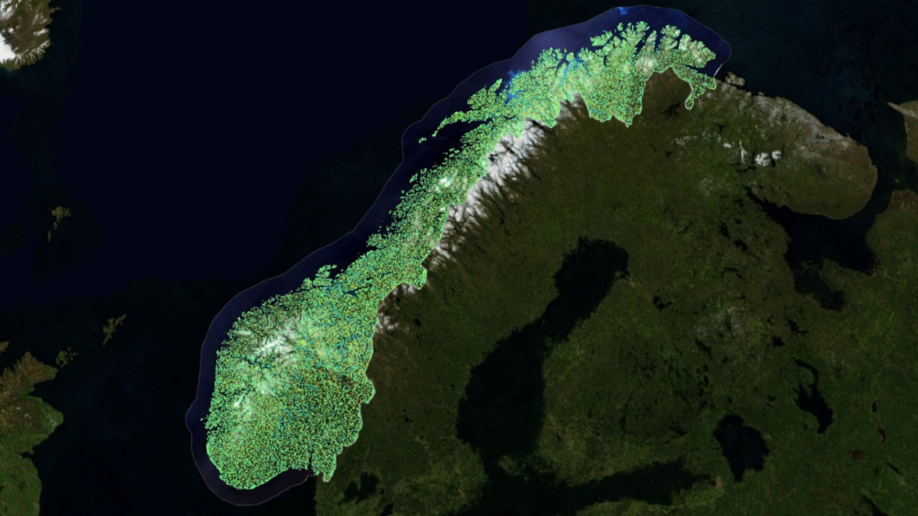
Planning a trip to Scandinavia often starts with one look at the map of Norway. At first glance, the country appears as a long, jagged sliver of land clinging to the western edge of the Scandinavian Peninsula. But look closer, and you’ll realize that Norway’s geography is a complex labyrinth of deep glacial valleys, over 1,000 fjords, and a coastline so long it could circle the Earth several times.
Whether you are navigating the bustling streets of Oslo or seeking the remote silence of the Arctic Circle, understanding the layout of the land is essential. In this guide, we’ll break down the map of Norway into manageable regions, helping you plan your route through one of the most ruggedly beautiful countries on the planet.
Key Takeaways
- Regional Split: Norway is traditionally divided into five main regions: Eastern, Southern, Western, Central, and Northern.
- Fjord Central: The most iconic fjords are located on the Western coast, between Stavanger and Kristiansund.
- Arctic Access: About one-third of Norway lies north of the Arctic Circle, including the Lofoten Islands and North Cape.
- Border Basics: Norway shares land borders with Sweden, Finland, and Russia to the east.
- Travel Logistics: Due to mountains and water, traveling short distances on a map can take hours by road or ferry.
1. Eastern Norway (Østlandet): The Urban Hub
When you look at the bottom-right section of a map of Norway, you are looking at Østlandet. This is the most populous region and home to the capital city, Oslo.
- Landscape: Unlike the jagged west, this area features rolling hills, vast forests, and the country’s largest lakes.
- Key Cities: Oslo, Lillehammer (home of the 1994 Winter Olympics), and Drammen.
- Best For: Museums, high-end dining, and easy access to the Swedish border.
2. Western Norway (Vestlandet): The Fjord Kingdom
This is the “poster child” region of Norway. If you see a photo of a steep cliff dropping into turquoise water, it was likely taken here.
Famous Fjords to Locate
- Geirangerfjord: A UNESCO World Heritage site known for its dramatic waterfalls.
- Sognefjord: The longest and deepest fjord in Norway, stretching over 200 kilometers inland.
- Hardangerfjord: Famous for its fruit orchards and the spectacular Trolltunga hike.
Read More: Things to Do in the Maldives
Major Coastal Cities
Bergen is the heart of the west. On the map, it sits nestled between seven mountains and acts as the gateway to the fjords. Further south, you’ll find Stavanger, the oil capital and jumping-off point for Preikestolen (Pulpit Rock).
Comparison: Norway’s Main Regions at a Glance
| Region | Climate | Top Attractions | Famous For |
| Eastern | Temperate | Oslo Opera House, Mjøsa | Cultural Hubs |
| Western | Rainy/Mild | Sognefjord, Bergen | Epic Fjords |
| Central | Continental | Nidaros Cathedral | Viking History |
| Northern | Arctic | Lofoten, North Cape | Northern Lights |
| Southern | Sunny (for Norway) | Kristiansand Zoo | Summer Beaches |
3. Northern Norway (Nord-Norge): The Land of the Midnight Sun
Stretching far into the Arctic, the northern map of Norway covers a vast, sparsely populated wilderness. This is where the sun never sets in summer and the Aurora Borealis dances in winter.
- The Lofoten Islands: On the map, these look like a string of pearls jutting into the Norwegian Sea. They are world-famous for red fisherman’s cabins and jagged peaks.
- Tromsø: Known as the “Paris of the North,” this is the largest city in the Arctic region.
- North Cape (Nordkapp): The northernmost point in Europe accessible by car.
4. Central Norway (Trøndelag): The Historical Heart
Sitting right in the middle of the map of Norway, Trøndelag bridges the gap between the urban south and the wild north.
- Trondheim: This city was Norway’s first capital and remains a spiritual center due to the Nidaros Cathedral.
- Pilgrimage Routes: Much like the Camino de Santiago, Norway has the St. Olav Ways, which converge in this region.
5. Southern Norway (Sørlandet): The Norwegian Riviera
The southernmost tip of the map features a coastline dotted with white-painted wooden houses and sheltered rocky harbors. It is the favorite summer destination for locals.
Conclusion
Studying a map of Norway reveals a country designed by nature to be explored slowly. From the deep cultural roots of Oslo in the east to the gravity-defying cliffs of the western fjords and the icy majesty of the north, every inch of this map offers a different adventure. Don’t try to see it all at once—pick a region and let the landscape dictate your pace.
Would you like me to help you create a custom 10-day itinerary based on one of these specific regions?
Frequently Asked Questions (FAQ)
Q: What is the best way to travel between regions in Norway?
A: For long distances (like Oslo to Tromsø), flying is fastest. However, the Bergen Railway is considered one of the world’s most beautiful train journeys and is the best way to see the transition from East to West.
Q: Does the map of Norway include Svalbard?
A: Geographically, Svalbard is an archipelago located about halfway between mainland Norway and the North Pole. While it is part of the Kingdom of Norway, it is usually shown as an inset on most maps due to its distance.
Q: Why do roads on the map of Norway look so zig-zagged?
A: These are “hairpin turns” necessitated by the steep mountains. Norway is also home to the Lærdal Tunnel, the longest road tunnel in the world (24.5 km), which helps cut through the mountains shown on your map.
Q: Is it easy to drive across the fjords?
A: You will frequently rely on car ferries. When looking at a map of Norway, look for dotted lines crossing the water—these indicate ferry routes that connect the main highways.