
Gokyo Travel Guide (Nepal) Revealed
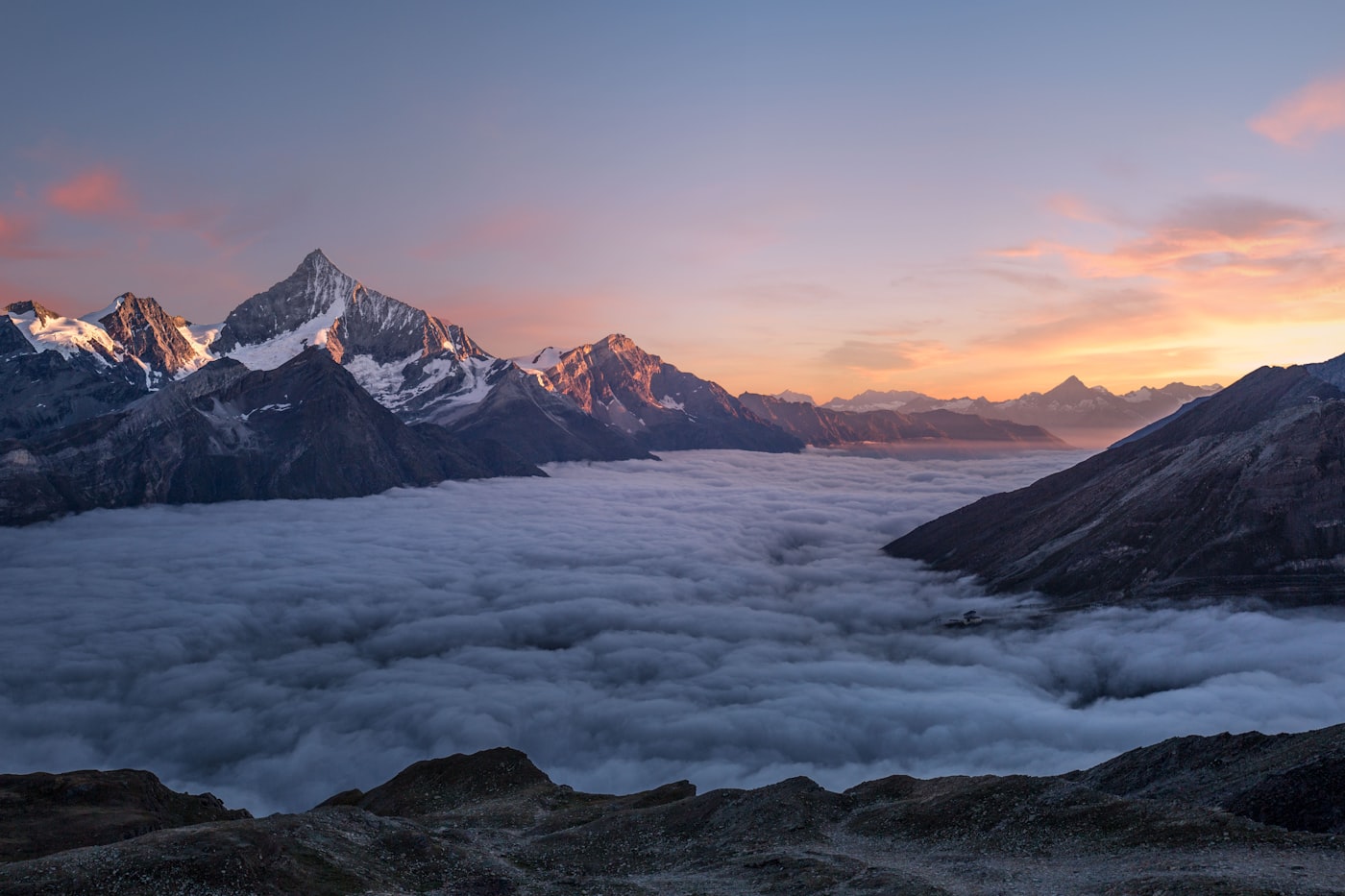
Gokyo is the valley in the Everest region that the crowds race past. Most trekkers head straight for base camp, and in doing so they miss a string of turquoise lakes, a glacier the size of a small country, and one of the finest viewpoints in the Himalaya. I spent five days in the Gokyo valley, and it became the part of my Nepal trip I talk about most. This guide covers everything practical you need to plan your own visit.
Where Gokyo Actually Is
Gokyo is a village beside the third and largest of five glacial lakes in the Dudh Koshi valley, just off the main Everest trekking corridor. It sits at roughly 4,700 meters, which makes altitude your main consideration from the moment you arrive. The village is reached by a branch trail that peels away from the busy route at the town of Namche. That detour is why so few people make it, and why it feels so quiet.
How to Get There
Your journey starts with the flight from Kathmandu to Lukla, a short but dramatic landing on a cliff-edge runway. From Lukla you trek through Namche Bazaar and then take the side route over the ridge and down into the Gokyo valley. The walking takes several days if you adapt properly. Do not rush it. Speeding up to save a day is exactly how people get altitude sickness.
Permits and Paperwork
You need to organize permits before you set out, because the authorities enforce them carefully and skipping them risks turning you back at a checkpoint. The Khumbu region in which Gokyo sits requires both a national park permit and a local municipality permit, and these are issued in Kathmandu or at a series of offices along the route. I sorted mine through my trekking agency and saved myself the queuing. Carry the paper documents with you at all times, since you will show them more than once, and keep a photocopy separate from the originals in case one is lost.
The Trails and the Lakes
Inside the valley, the trails are gentle and well marked. I walked the full chain of lakes in a leisurely afternoon, and it is the perfect introduction. For the effort, nothing matches the climb of Gokyo Ri, the dome above the village that gives you Everest, Lhotse, Makalu, and Cho Oyu in a single sweep. The Ngozumpa Glacier below the lakes offers a harder, more primal outing for those with a guide.
Altitude and Safety
This is the one point I cannot repeat enough. At 4,700 meters, acute mountain sickness is a real risk, and it can turn serious fast. Climb slowly, sleep low relative to your walking day, drink plenty, and know the warning signs: persistent headache, nausea, loss of balance, and confusion. If those appear, you descend immediately. Carry the contacts for a local rescue service and keep your guide informed of how you feel.
Where to Sleep and Eat
Teahouses in Gokyo are simple but welcoming. Expect a basic room, shared facilities, and a dining room centered on a stove that is the warmest place in the building. The food is filling if not fancy: thukpa noodle soup, momos, porridge, and rice dishes. Nights are cold at that height, so a good sleeping bag and warm layers are not a luxury, they are essential kit.
What to Pack for Gokyo
Layers are your whole strategy: a warm base, an insulating midlayer, and a windproof and waterproof shell. Add a solid down jacket for the summit climb before dawn, good gloves, a warm hat, sunscreen, sunglasses against the intense glare, and lip balm. Sturdy, worn-in boots are non-negotiable on the rocky trails, and water treatment tablets are wise because clean water is limited.
How Long You Need
I would spend three to five days in the valley itself, plus the approach time from Lukla, making the whole Gokyo loop about ten to twelve days. That allows for proper acclimatization and the reserve to wait out bad weather before the Ri climb. Rushing to two days converts a beautiful walk into a risk. Give it the time, and give the height the respect it demands.
Getting an Adjustable Itinerary
My most important piece of advice is to build slack into your days. The flight into Lukla is famous for cancelling in bad weather, and a single day of cloud can ripple through a tightly packed plan. I added a buffer day on each end of my trek, and that flexibility let me wait out weather and still finish on schedule. If you have the days, spread the altitude gain across an extra night rather than pushing onward. The relaxed plan is the one that actually works in this valley.
Final Practical Notes
Carry cash, because card readers are rare up high. Get a local SIM or eSIM for the trail network, and download offline maps for the sections without signal. Book teahouse beds ahead when you can in peak season. And above all, listen to your body and your guide. Gokyo gives generously to travelers who treat the altitude properly.